
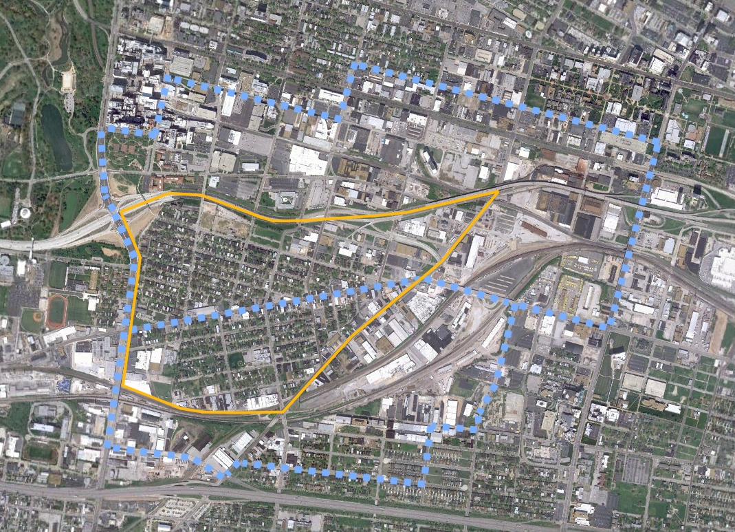
 Forest Park Southeast is a south St. Louis neighborhood bound by I-64 to the north, the rail line and I-44 to the south, Vandeventer Avenue to the east and Kinshighway Boulevard to the west.
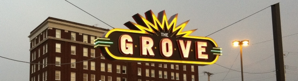


Two census tracts (outlined in blue), 1186 (top) and 1181 (bottom) overlap the neighborhood (outlined in yellow). The 2005-09 American Community Survey estimates a combined 4,540 residents, while the 2000 census counted 4,970 residents, an almost 9% decrease in population.
However, FPSE is a tale of two neighborhoods, north and south of Manchester Avenue. North of Manchester is estimated to have gained 8% in population, with south of Manchester losing 33%. Vacant property north has increased 9% while increasing 35% south. Racial demographics are starkly different as well. The white population is up 76% overall, 29% south and 97% north. The black population has decreased 38% overall: 47% south and 31% north. In 2000, the neighborhood was 25% white and 75% black. Today it is estimated to be 49% white and 51% black.


From the FPSE website:
Forest Park Southeast is an up-and-coming neighborhood with a mix of single- and multi-family homes on quiet streets along with trendy restaurants and bars in the Grove district along Manchester Avenue. FPSE comprises the four distinct neighborhoods of Adams Grove, Gibson Heights, New Boyle and Ranken East.
The neighborhood is convenient to Washington University Medical Center, Barnes Jewish Hospital, St. Louis Children’s Hospital, the Central West End, the Science Center and, as its name implies, Forest Park. Forest Park Southeast is located near both Interstate 64/Highway 40 and Interstate 44, with a Metrolink stop just a few blocks north of the neighborhood.
The above mention of proximity to BJC is very true, and with the upgrade of I-64, there is a nice pedestrian crossing to access BJC, the CWE and Forest Park. FPSE is also a quick jog down Tower Grove Avenue to the Missouri Botanical Gardens.

{view across I-64 footbridge looking north from FPSE}

{view of I-64 footbridge looking south from Euclid Avenue}
It’s also good to see I’m not alone in calling this an “up and coming” neighborhood.
A little history from the FPSE website:
Before 1989, the Forest Park Southeast neighborhood had been known by various names over the years. Originally, the area was known as Rock Spring, named for the large spring that was the principal source of the Mill Creek. Rock Spring drew a large crowd from the central city and became a resort where they could get away from the urban grind. The demographics of the area changed drastically, though, with the arrival of the Pacific Railway and the influx of industry that followed (www.stlouis.missouri.org). The construction of the Missouri Pacific railroad tracks and Manchester Road to Jefferson City in the 1850s made FPSE accessible.
However, Forest Park Southeast was developed primarily at the turn of the 20th century. The neighborhood was originally marketed as the city’s first “subdivision” and was popular because of its convenient proximity to downtown and industry. Much of the housing development occurred prior to 1915 with infill activity occurring throughout the succeeding decades. Commercial development occurred primarily between 1930 and 1950.
Here is a reminder from the Rock Spring moniker for the neighborhood, the shuttered Providence Educational Center nee Rock Springs School):

As you can tell from the map and the description above, the south side of FPSE is defined by the railways. Among other operations, you’ll find the City water division, Henry Plumbing (an excellent source for plumbing parts of all kinds), the Bed Guy, Luth Construction, and other various warehousing, distribution and light industry operations both operational and long since closed:


The south side of FPSE (using Manchester as the dividing line) has a high concentration of boarded up and abandoned properties:

Notice the black spray painted symbol on this property? They are all over the place in FPSE. Restoration Saint Louis is a company of Amy and Amrit Gill, who were responsible for the renovation of the Moolah and Coronado in Midtown among other things. This is probably a good sign for FPSE:

There are probably more abandoned homes and corner storefronts in FPSE than any other south side neighborhood I’ve visited so far:


There are examples of new construction from the 1980’s through the early 21st century:


It’s pretty clear that the late 20th century inhabitants of FPSE were not the best stewards of the neighborhood. However, I really think things are looking up.
Don’t get me wrong, the south side of FPSE is cool, it just needs some TLC and an influx of people who want smaller shotgun homes.


The section of the neighborhood north of Manchester has seen much more investment in the last 10-15 years. There is major potential here, especially with all the corner commercial opportunities:


{La Dolce Via – an attractive cafe with sidewalk seating.}


{This is one of my favorites. Check out the windmill above the 2nd floor window.}

{And this is right next door to the cool red building. The sign reads: “Center for Survivors of Torture and War Trauma”}


{One rehabbed, one to go.}

Many of the streets are closed off with bollards and cul de sac’ed. I still don’t get why this is necessary.

And if those photos don’t convince you that FPSE is a great up and coming neighborhood, the recently proposed Chouteau Park space near the former natural gas towers has a huge potential to draw people to FPSE, and it will be visible from I-64 and the Tower Grove Ave. exit:

Adams Elementary is on Tower Grove Avenue and has a modern upgrade to match the original structure built in 1899.


Directly adjacent to the school is another Cardinals Care baseball field, this one dedicated to former center fielder Jim Edmonds:

According to this source:
Edmonds donated $1 million — $200,000 each season from 2001-05 to the team’s charitable arm, Cardinals Care. Cardinals Care unveiled Jim Edmonds Field in June 2001 in Forest Park Southeast.
Don’t like the public schools? How about a French and Spanish language immersion charter school? The first of it’s kind in the area can be found at 4011 Papin Street:

Some nice old churches dot the neighborhood:


But the real claim to fame for FPSE is its main street commercial district, Manchester with several businesses services, night clubs and restaurants deemed the Grove. When I first moved to STL in 1994, This stretch of Manchester between Kingshighway and Vandeventer was pretty desolate; it’s amazing how much progress has been made in the last 10 years:


{This storefront is sweet.}


{I like the senior assisted living buildings, just not the empty corner at Manchester and Kingshighway.}


Many buildings along Manchester have been redone. However there are still a handful that await their turn:

Some sights along Vandeventer:

{The former Billy Goat Tavern}

{This stretch of store front is attractive, can’t understand why things haven’t taken off here.}
A former fire station is available for sale/lease:

I really like the Chouteau building, too bad it’s fallen victim to some urban poaching:

The Thomas Coffee Co. headquarters on Boyle is an impressive employer, who seems committed to the city and has been featured here on urbanSTL. They’ve been roasting coffee under this roof since 1905.

Thomas isn’t the only coffee roaster in FPSE:

FPSE has seen an amazing amount of investment over that last 10 or so years. I think the positivity will continue both north and south of Manchester to make FPSE yet another great south side neighborhood that will draw all kinds of people to live, work and play.
In some ways, FPSE continues to be on the cusp of something great. A number of businesses along Manchester Avenue have recently closed, including Mia Rosa, FIVE, Newstead Tower Public House and others. New businesses have moved in: The HandleBar, Randy’s Recycled Cycles, Flavors, Not Just a Bookstore and more. SPACEarchitects recently moved from Webster Groves into one of the least attractive buildings on Manchester, turning it into a landmark with an incredible renovation.
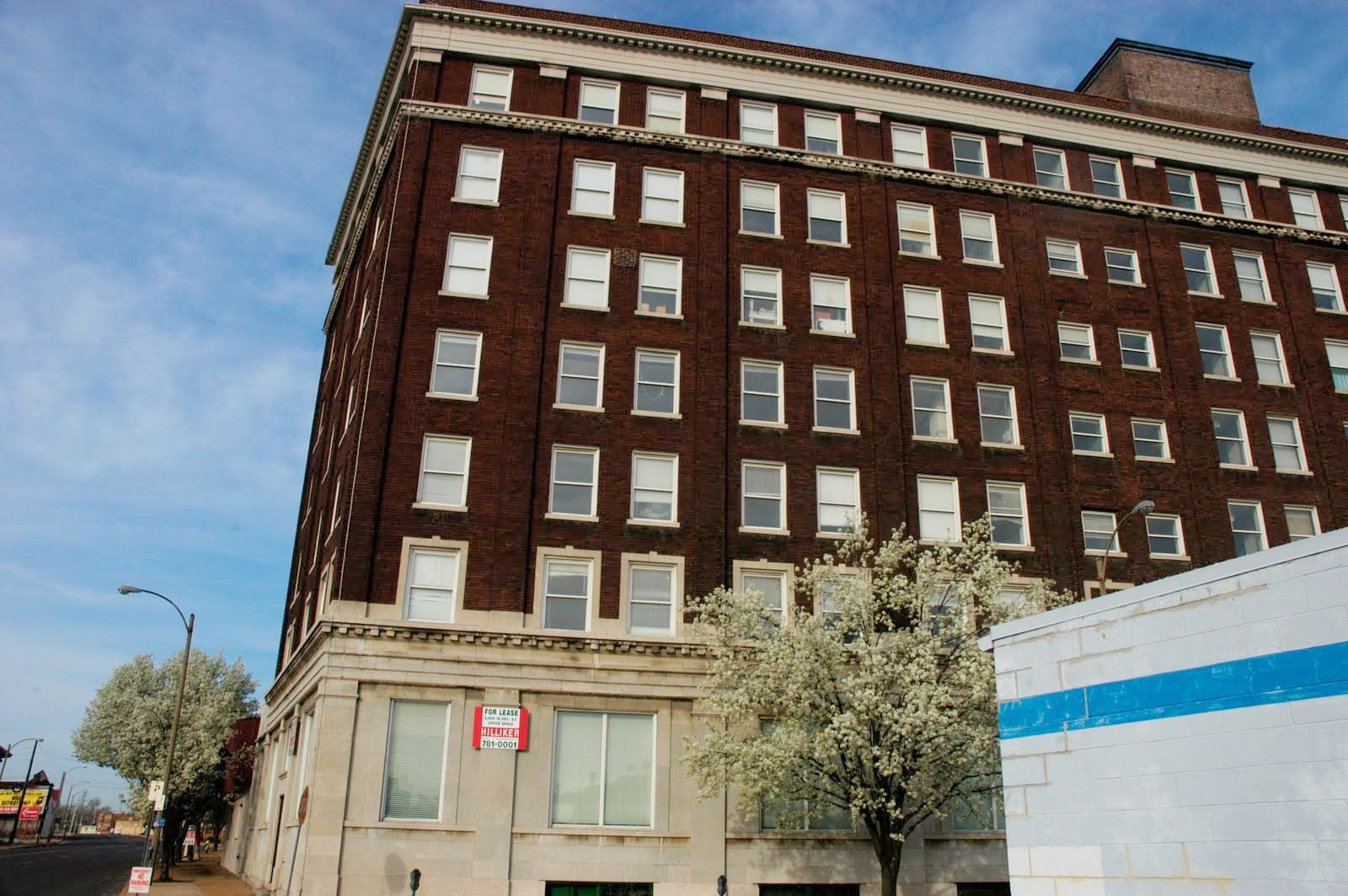
The largest projects include the newly installed “Grove” neon sign over Manchester at the east end of the neighborhood, a proposed 200+ unit, four story apartment building at Chouteau and Taylor, the multi-million dollar Manchester streetscape project, potential conversion of the seven story building at Manchester and Vandeventer into a hotel, the redevelopment of the very large Commerce Bank site and the now two-year-old proposal to build a twin tower Drury Inn at Kingshighway and I-64.


{Chouteau-Taylor development rendering}

{Chouteau-Taylor siteplan}

{early rendering of proposed Drury Inn}

{most recent rendering of proposed Drury Inn}
In addition, modern single-family residential infill has been proposed for FPSE (urbanSTL story here).

{proposed infill project by UIC + CDO}

{ecourban rendering of residential infill in FPSE}

{site plan for potential infill south of Manchester}

{SPACEarchitects office before}

{SPACEarchitects office after}

{newcomer Randy’s Recycled Cycles and mainstay the Atomic Cowboy}
Forest Park Southeast continues to change, but has maintained much of its history. Nearly all buildings shown in the 1950’s photos are still standing on Manchester.

{FPSE prior to development as St. Louis’ first subdivision}

{Vandeventer at Chouteau – 1925}

{Manchester at Tower Grove in the late 1950’s}
