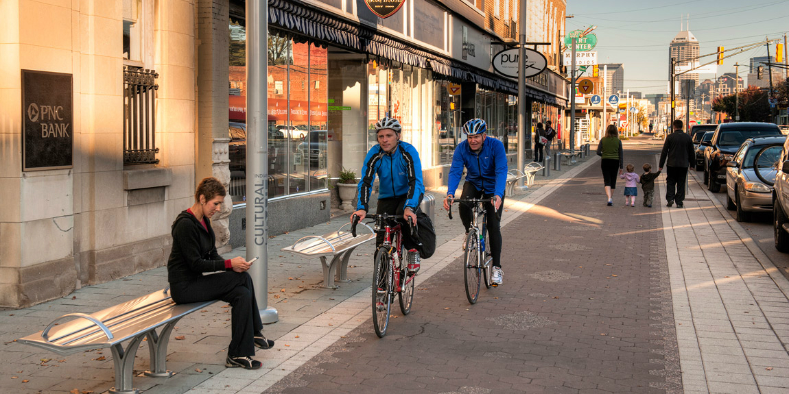

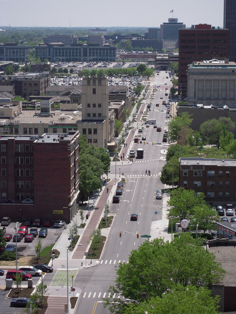
In 2001 Indianapolis proposed that five central city neighborhoods be designated cultural districts. Taken together, they were home to nearly every significant arts, cultural, heritage, sports, and entertainment venue in the city. The problem? The neighborhoods were poorly connected and lacked an identity. The solution? The Indianapolis Cultural Trail.
Completed in 2012, the $63M 8-mile multi-use trail was funded by $27.5M in private and philanthropic support, and $35.5M from federal transportation grants. A recent study has found that since the project announcement and groundbreaking in 2007, property values within 500ft of the trail have increased by 148%, or more than $1 billion.
 The trail has increased revenue and traffic for businesses along the route. The average trail user spends $53 at local businesses. 95% of users feel safe using the trail. 40-50 new full-time, and 47 new part-time jobs were added at businesses along the trail since its opening. In Fletcher Place, 73 percent of businesses responding to the study’s survey were established after 2010, well after work on the Cultural Trail began. The trail also provided Indianapolis a natural anchor for it’s 250-bike, 25-station bike share program. A bike share project in St. Louis is currently stalled for lack of funding.
The Cultural Trail has been a huge success. Beyond the numbers, it’s help change the perception of Indianapolis as a city. The trail has put a new face on Indianapolis, encouraging human-scaled exploration of the city by locals and visitors alike. There’s new residential infill, private investment, and a greater awareness of the city’s cultural assets and urban neighborhoods. Planners from Cologne, Germany to Miami, Florida have traveled to Indianapolis to study this success. St. Louis should do this.
St. Louis has nothing like the Cultural Trail. There’s the Forest Park multi-use path, which doesn’t even explicitly connect the cultural attractions within the park. The new wayfinding is very nice, but visitors still wander the park without intuitive connections. The park also plays poorly with surrounding city neighborhoods. There’s the Gateway Mall hallway, but that’s just a couple blocks.
We also have the Great Rivers Greenway (GRG) system, clearly the nearest example, but it is also clearly falls short. The greenways explicitly aim for a different mission – connecting the region with recreational paths, largely using old rail right-of-way, or unused land. What is the return on investment of the Centennial Greenway along I-170? Not a lot. It’s an effective low-cost strategy to build a lot of miles of paths. But a bigger opportunity is being missed.
 {Centennial Greenway alongside Interstate 170 in St. Louis County near Clayton, MO}
GRG has become more aware of urban connections. Being a part of the CityArchRiver project may have been more political than practical, but a nice multi-use path has emerged on the riverfront. Unfortunately, it doesn’t connect much, and there’s zero development potential at the Arch itself. The north city Trestle is still being planned, though it would eventually connect to an industrial zone that’s planned to remain an industrial zone.
Then there’s the Midtown Loop idea to connect parts of Cortex with an eventual Chouteau’s Greenway to downtown, and via Forest Park paths to the Des Peres, Centennial, and St. Vincent Greenways. This may be the most frustrating plan of all as it comes nearest to getting it right, and being a economic development asset.
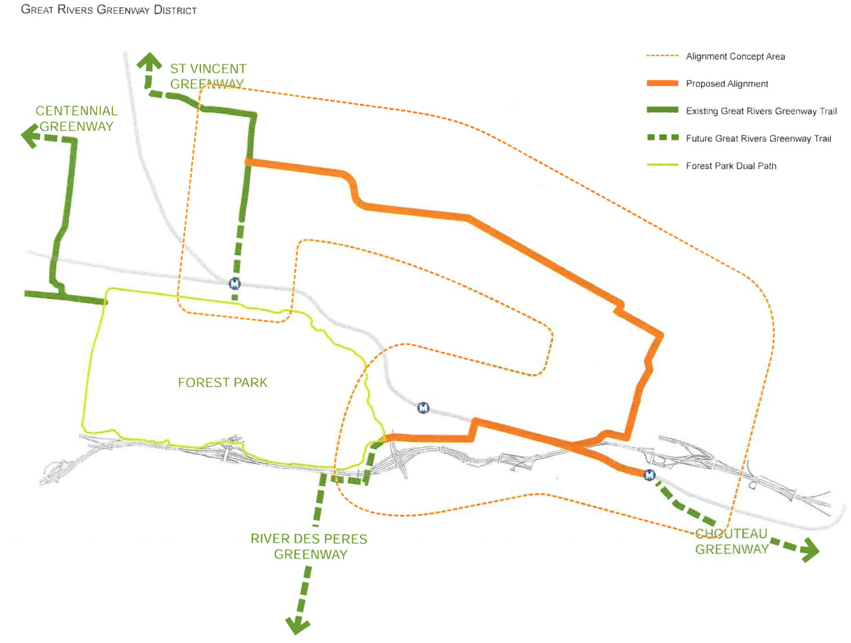
That trail, as currently envisioned, would follow Clayton Avenue, then snake along the MetroLink right-of-way, cut through the Saint Louis University Frost Campus, avoid the center of Grand Center, then follow the old Hodiamont street car right-of-way north and west that today functions as an alley. The route takes the path of least resistance, and so the path of least positive impact. To leverage assets like the Cultural Trail, the Loop would need to run on Lindell and Grand, or least on Duncan through Cortex.
Here’s what’s missing: the investment in St. Louis is being spent in out-of-the-way places, next to Interstate highways, along old rail lines in residential areas, on side streets and empty land on the edges of successful development, and not as a part of it, in the middle of it, where people want to go. We’re not capitalizing on our investment.
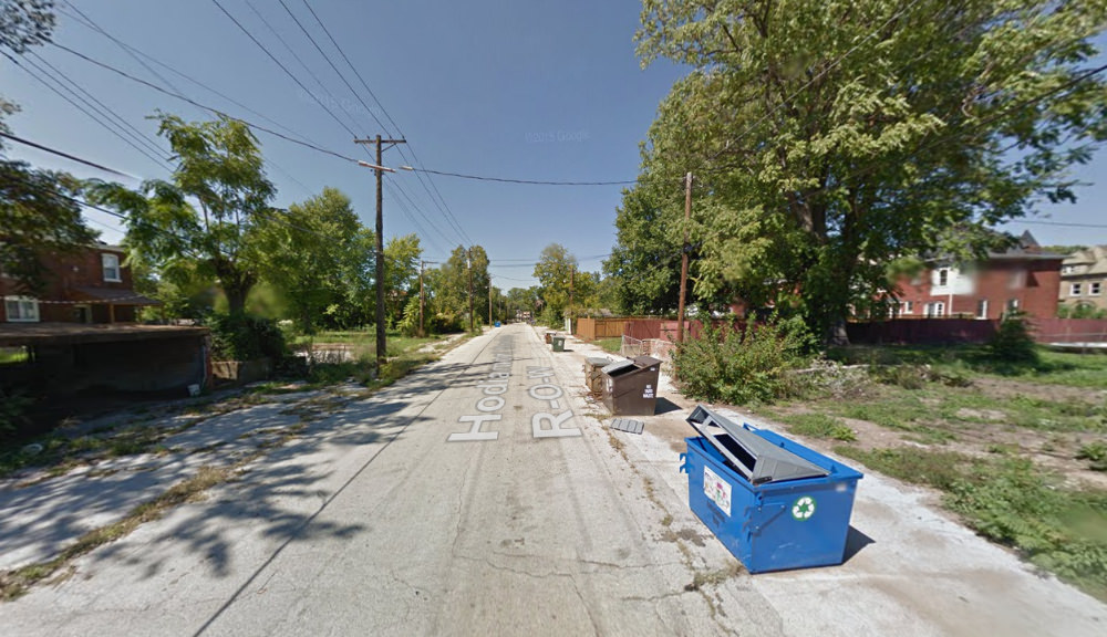 {the Hodiamont street car right-of-way}
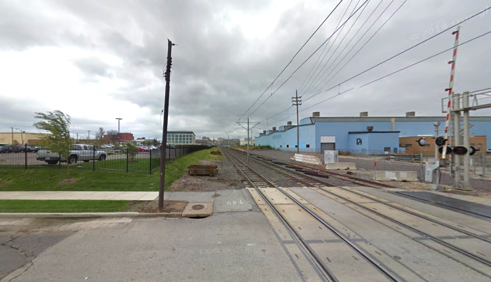 {the Midtown Loop would run alongside MetroLink light rail right-of-way}
Here’s where the St. Louis Cultural Trail should go: connect the Old Courthouse/Arch, City Garden, Central Library, Grand Center/SLU, Central West End/Cortex/medical campus/Forest Park with off-shoots to Old North, Soulard, and Missouri Botanical Garden. Eight miles of on-street infrastructure connects them all.
The key is building the trail where it will be used, where it will catalyze development and where it can augment the built environment and existing investment. This is more expensive and more difficult than greenways under power lines next to an Interstate, but it also has an exponentially greater impact.
 {the Cultural Trail is built as part of the city’s transportation network}
These paths, investment in bicycle and pedestrian infrastructure, work best when they act a part of a city’s transportation network, as connective tissue, when they directly address difficult connections. They’re best when not simply a place to walk or ride, but when used to go somewhere, and when, as often as practicable, the path is also a place.
Atlanta’s Beltline has been a big success and is a bit of a hybrid greeway-urban path, a 22-mile circular route connecting neighborhoods around downtown, but running in an old rail right-of-way. Chicacgo’s 606 is a 2.7-mile straight line path on a former rail line, but it connects dense urban neighborhoods that were in need of green space. New York’s High Line is a very different project in a singular city.
St. Louis has museums, parks, and cultural assets that should make Indianapolis (and Atlanta, and maybe Chicago) blush. The city’s historic neighborhoods are as rich, beautiful, and diverse as any American city, but they’re not connected. Current strategy and plans for bicycle and pedestrian paths won’t address this shortcoming. We need to stop doing what’s easy, and start doing what’s effective.
 {focusing on clear and safe infrastructure at intersections is key to creating a path network – image by John Greenfield via newcity.com}
 {the Cultural Trail would easily fit on many St. Louis City streets}
We’re not doing what’s necessary to capitalize on our assets. Getting to and from, and between, the best our city has to offer is often ugly, uninspiring, and even dangerous. Indianapolis has figured this out in a big way. It’s time to steal their idea.
Perhaps the city’s new traffic engineer focused on how residents on bicycles and walking are accommodated can help pull together a cohesive strategy. Maybe Forest Park Forever with neighborhood partners at Washington University and the Central West End can get started on it. Maybe the next iteration of CityArchRiver can look to the next layer and help connect city neighborhoods to the Arch and river. Perhaps GRG can continue its urban evolution, maybe Trailnet can help with planning.
A St. Louis Cultural trail would not only benefit its immediate environs, it could anchor and give impetus to more basic, affordable, and widespread infrastructure. By planning protected bike lanes, sidewalk replacement, and bike routes to connect with the trail, the network could be effectively prioritized, phased and constructed. The result would be a system much greater than the sum of its parts.
The existing 110-miles of greenways from Dardenne Prairie (37 miles west of the Arch) to the North Riverfront Trail are a great asset to the region. The planned 600-mile network is an important investment, but no organization is yet focused on leveraging what’s best about St. Louis into something greater, on connecting the dots. We are currently doing less with more. It’s time to steal Indy’s Cultural Trail.
St. Louis bicycle and pedestrian infrastructure:
 {protected bike lane, downtown St. Louis}
 {Gateway Mall hallway at City Garden}
 {Forest Park multi-use path at Skinker Boulevard – image by Andrew Conway}
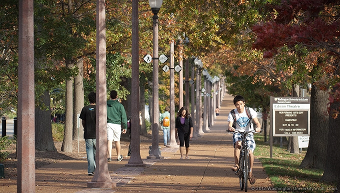 {the greenway at WUSTL’s Danforth Campus runs for 1/2mi along Forsyth Boulevard}
