
John Hoal of H3 Studio laid out some options for a Sustainable Development Plan & Code for the Central West End-South today. Why only South (see map at end of post)? Well, you can thank the Aldermanic system of St. Louis for that one. I do praise Alderman Joe Roddy of the 17th Ward for his role in organizing this effort, the meeting and for involving John. This process is necessary and important. However, it continues to be a huge disappointment that we fail to treat the Central West End as the cohesive unit it is to everyone outside our antiquated political system.
Below you will find the two options presented at the forum. It was made clear that participants were not to choose one or the other, but to look at components of each that they may like.
If I had to very quickly summarize the majority view (there were a large variety of opinions) I would say that most were in favor of Option A with some alterations, including consideration of green space, preserving scale of Euclid Avenue, preserving all historic buildings and pushing highest development further towards Kingshighway.
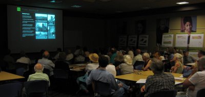
John had an excellent presentation which I hope to post here soon. I encourage you to view the entire presentation as there were some excellent visuals and further explanation of the points below. But until then, what do you think. Do you come down on the “higher and more dense is better” or “let’s preserve as much as we have and be more conservative”?
Option A: Modified Existing EnvelopeBuilds upon the Strategic Land Use Plan & Zoning by emphasizing new development in the “Development Areas”, similarly scaled development in the core of the “Preservation Area”
Introduces the idea of restrictive “height ranges” (max & min) for development which provides flexibility for the developer to respond to market pressures and creates incrementally a varied skyline
Introduces the idea of stepping down the height towards the core of the “Preservation Area”
Builds upon the retention of historic assets in the core of the neighborhood
Responds to the civic building character of Grand Center along Lindell Boulevard and Vandeventer AvenueEncourages new development along the length of Forest Park Avenue (6-16+ stories)
Encourages higher infill development along Lindell Boulevard (6-16 stories)
Restricts “unlimited height” to Kingshighway Boulevard
Refines the boundary of the Preservation Areas west of Taylor Avenue, along West Pine Boulevard at Taylor Avenue and along Forest Park Avenue
Over the long-term permits the removal of some isolated historic structures (approx. 10)
Assumes all new development is urban in character and of high architectural quality
Option B: Contextual Envelope
Builds upon existing heights of historic structures, sites and districts
Introduces a system of nine height zones for infill development to ensure balance between a varied skyline and the integration of existing protected structures
All protected structures are retainedA minimum height of three stories for new buildings
Provides for the highest building envelopes along Kingshighway Boulevard (8-16 stories)
Retains the historic area along Forest Park Avenue and encourages adjacent compatible infill developmentTypically keeps and expands the boundary of the Preservation Area
Overall, a lower and smaller-scaled development strategy
A more particular and specific regulatory approach
Assumes all new development is urban in character and of a high architectural quality
