Closing a city street should require a deliberate, open, public process. In an historic city, altering the street grid in place since the end of the American Civil War, 150 years ago this year, should require the most deliberate, most open, most public process. In fact, if it were up to us, the St. Louis street grid would be on the National Register of Historic Places, be a City Landmark, and require a hearing and vote by the city’s Preservation Board to alter.
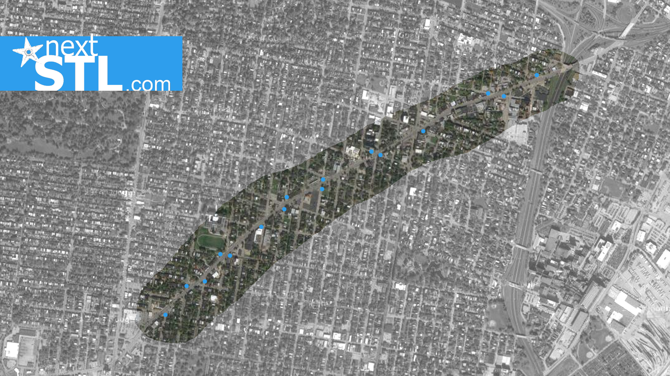
Of course this isn’t how street closures are handled in the City of St. Louis. Some are closed at the behest of an Aldermen responding to an unknown arbitrary (small) number of constituents. Some have been more planned. There’s a long history of closing streets in this city. Now, the Missouri Department of Transportation, responsible for state routes through the city, is presenting a plan to near south side neighborhoods to close 16 streets along Gravois Avenue from Russell Boulevard to South Grand Boulevard.

The plan is being presented as a fait accompli, with at least one neighborhood being told that while input from select places is being sought, all the other neighborhoods along Gravois are already on board. Proposed closures are location in the neighborhoods of Benton Park, Benton Park West, McKinley Heights, Fox Park, and Tower Grove East.
Widening the historic streets of the city have wreaked havoc on the pre-automobile city, decreased connectedness and walkability, eviscerating commercial strips. As we see the positive affect of removing traffic lanes on the sustainability of retail, and thus the city’s tax base, the proposed closures threaten to do the opposite by further prioritizing vehicle speed and traffic throughput over connectivity for all users.
What’s worse, this plan is being presented as an effort to improve pedestrian and bicycle safety. We suspect it’s a way to reduce the number and complexity of signals along Gravois, saving MoDOT millions of dollars. Closing city streets, even at intersections that can seem confusing, is not safer for pedestrians and cyclists. The number one priority for any pedestrian enhancement along Gravois should be to slow vehicle speed.
In a city that loves the mega-project, Gravois could fit. What if St. Louis prioritized capturing land value along this stretch? Narrow and reduce lanes, reduce vehicle speed, make it a place for people, fill vacant storefronts and implement better land use.
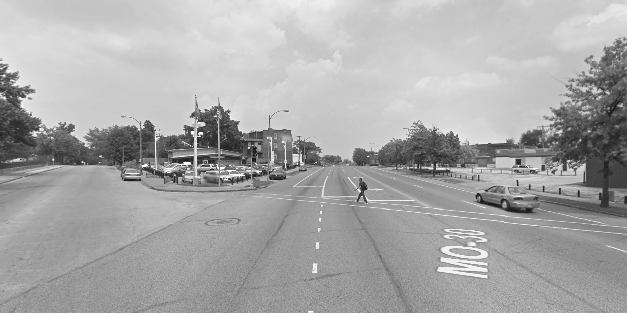
 {closing city streets won’t make this pedestrian crossing a sea of asphalt any safer}
 {six lanes of traffic and a 35mph speed limit on Gravois}
 {between neighborhood and highways speeds, streets lose their ability to capture value}
 {at 40mph, a common speed on Gravois, a pedestrian has little chance of surviving a collision with a vehicle}
What we do not know, but everyone should know (deliberate, open, and public process), is how this plan was put together, at whose behest, and with what input? Neighborhoods have been presented with a vague history that asserts the plan is somehow in line with the city’s Pedestrian Safety Action Plan, a federally funding plan to reduce pedestrian deaths in the city (St. Louis City averaged 11 pedestrian deaths annually from 2006-2010). That plan outlines objectives such as the “construction of new pedestrian facilities”, “changing the behavior of all road users”, and “addressing pedestrian safety, mobility, and accessibility.” One has to be a magician, or a traffic engineer, to pull 16 street closures from a pedestrian safety action plan.
Yet, as far as we know, the city has signed off on the plan. It’s a state route after all, the city doesn’t pay to maintain it, so what say does it have anyway? This is where the city must have a clear self-identity. As near as we can tell, that identity is “if there’s someone else who can pay for something, do it.” This isn’t just poor self-esteem, it’s terrible planning.
But we’re not quite ready to throw the street closure plan out just yet. The closures are at six-way intersections and generally, with a short jog, access is retained. It’s also possible there’s more to the plan than we know. Can Gravois be narrowed to no more than two traffic lanes in each direction? This would lessen the crossing distance, which is in some places more than 100ft to cross Gravois. Can the speed limit be reduced to 25mph, as on Lindell Boulevard, and be enforced? Can more robust crosswalks be added?
A map distributed to neighborhoods shows five pedestrian deaths along this 2-mile long stretch of Gravois from 2007-2011. One near Iowa Avenue, one near Nebraska Avenue and three near Compton, Virginia, Louisiana Avenues. The map shows quite an even distribution across the city, though clearly weighted to the north side by per capita pedestrian deaths, given its lower population. In fact, higher-speed corridors, often lined with street closures, show concentrations of deaths, including Kingshighway and Grand Avenue near Interstate 64.

There are challenges along Gravois, but they are the result of widening and adapting a pre-automobile street to prioritize moving as many cars as quickly as possible through the city. From the beginning, these streets worked for people. It’s very unclear that the plan being presented as a done deal, has been derived from any worthwhile process. It’s very unclear that the solution will address the problem. The hollow assurance being offered to some that many options were considered in various workshops, but eliminated due to being against city policy (is there one?), too difficult, or too costly, shouldn’t be allowed to go unchallenged.
A city contemplating a plan such as this without a deliberate, open, public process, and input from a wide variety of experts in pedestrian infrastructure and urban transportation, isn’t serving its residents. A city doing this isn’t planning for a sustainable future. St. Louis Mayor Francis Slay’s Communications Director Maggie Crane recently stated “We’d like to become a “stop for pedestrian” city,” instead of a “yield for pedestrian” city. We can change the language of the law, but if we continue to build a city for cars and call it a pedestrian improvement, nothing will change.
If the city wants to become a welcoming, safer place for pedestrians, there are more than a couple people it should contact, including Jeff Speck, author of Walkable City, Dan Burden, Charles Marohn of Strong Towns, Mark Fenton, Todd Litman, Brent Toderian…they’re all inexpensive compared to the millions planning to be spent on this project. Of course, the city could listen to local experts and save a dime if that’s the hangup.
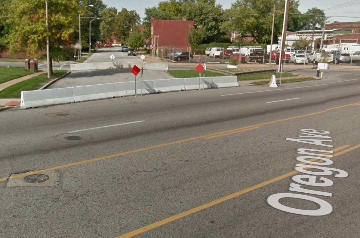
 {some short sections of streets have already been closed with barricades}
Preliminary plans for closures along Gravois Avenue:


