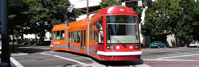
The Saint Louis Urban Workshop is taking a page from Urban Milwaukee where a new streetcar line has found 60% of the needed $91.5 million for construction. Your task is to design a new St. Louis streetcar line. We may not have a “shovel-ready” project, but there’s no time like the present to begin thinking of where such a streetcar should be located. The Loop Trolley project is moving forward, East-West Gateway has studied potential north-south Metrolink expansion, alternatives need to be considered.
It’s tempting to think BIG, but let’s limit the proposal to 4 miles in total track length.
Here’s what to do:
1. Use you Google account or create one if you don’t have one.
2. Create a route (not longer than 3 miles) using Google Maps. Don’t know how to do this? Click here for an introductory video if you need it.
3. Paste a link to your route in the comments of this post.
So what do you think and why? Who would the line serve? The Central West End to downtown? Midtown to South Grand? Old North St. Louis to Soulard?

