One would think that the US would have a museum dedicated to the history, interpretation, and evolution of maps–a National Map Museum if you will–but we do not. If such a place existed, you might expect to find it on the National Mall in Washington D.C. among all the other great institutions there that hold our nation’s treasures. But there’s another civic mall right here at home, with a regal old building just waiting to be turned into a museum. So, why not here? Why not now?
The Cultural Case
Foremost among many reasons is the relocation of the National Geospatial-Intelligence Agency. As it moves from its location at the former St. Louis Arsenal to its new campus in North St. Louis it bears along with it the institutional embodiment of maps as defense of space. While the move is already creating momentum for redevelopment in the long struggling North Side, there is a larger historical context to be understood than simply new opportunities for growth.
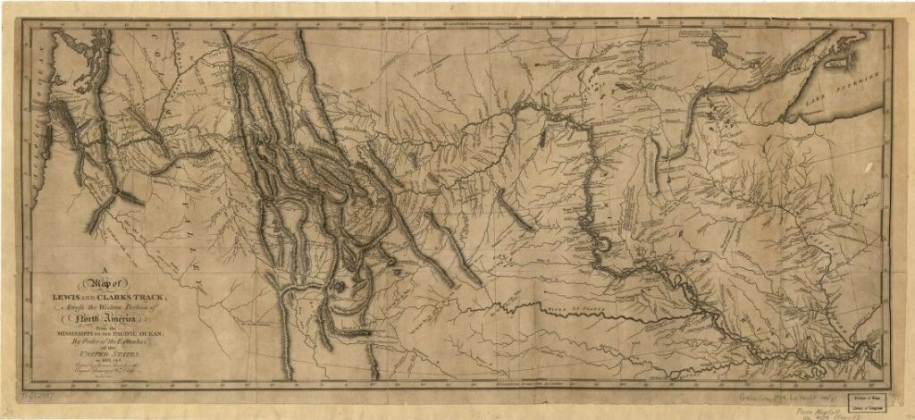
Another St. Louis long ago was the nation’s major outpost for the westward expansion of the United States. The maps which would define the nation, living documents used first for diplomacy and trade, then acquisition and defense, and eventually maps drawing relocation, assimilation, and annihilation came from St. Louis. Even in the NGA’s own promotional materials –The legacy of Manifest Destiny draws a direct line to their own existence. Others, famously, connect this legacy and STL’s intervening history of racial redlining and slum clearance. The history of mapping land use in St. Louis is a complicated story–one we owe it to ourselves to understand, especially as we take on the responsibility anew of mapping and defending space.
That is, If we aim to continue our trajectory as a growing mapping city–and if the recent GEOINT Symposium is any indication it appears we do–we should not merely understand ourselves as mapping for military intelligence, or mapping for economic growth, but also as mapping for cultural understanding. This cultural edification works in more than one direction– STL Professionals in mapping have an opportunity to educate the public on the new technologies and strategies in mapping, historians have an opportunity to inform professionals and the public about the deep psychological and social impacts of their work, and the public has an opportunity to understand and empower their own stories though map-making–a mutually beneficial relationship.
The new NGA campus joins a number of cultural institutions in St. Louis including the Missouri History Museum, St. Louis Public Library, National Transportation Museum, National Building Arts Center, and a growing number of private mapping institutions like ESRI, that recently announced a move to the Globe building in Downtown St. Louis where many firms already reside. Some are arguing that we’re reaching a kind of critical mass of mapping “intelligence”. That intelligence, both technical and cultural, could be brought to bear on St. Louis’ rich, if checkered, history alongside being part of its future.
The Case for Tourism
Our darker history aside, maps are inherently exciting. Who among us would not visit a building filled with maps–permanent and rotating collections of historical, industrial, geographical, and municipal maps of all kinds–from old maps turned brown with age to the newest digital creations–Comprehensive STL maps like Pictorial St. Louis, Sanborn’s Fire Insurance Maps, and untold others ready for digitization, preservation, display, and interpretation (I’ve read there exists a New Deal Era St. Louis land use survey with maps rendered at a scale of one-letter-sized-page-per-block) all luxuriating in their rich detail for public consumption.
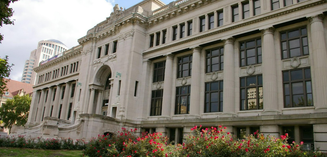
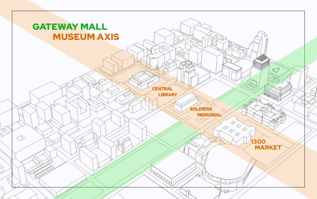
And what better place for this than the former Municipal Courts Building at 1300 Market Street, now languishing in disrepair, resting between City Hall and the Stifel Theatre along an axis of the civic mall that includes Soldiers Memorial and Central Library. A museum here would complete this historical/museum axis, helping to raise the profile of the Gateway Mall and Downtown West–adding another destination stop between the must-see attractions of the Arch grounds to the east and Union Station and the stadium district to the west.
The Case for Development
But the Gateway Mall needn’t be the only potential location, or even the only stop in STL for a citywide, statewide, or nation-wide map museum. Such an institution could, importantly, bring more civic identity with mapping where the NGA now builds its massive gated complex among the neighborhoods and ruins of North STL in the St. Louis Place Neighborhood. Interestingly, some compelling ideas for this can be found in the 1999 Chouteau Lake and Greenway plan.
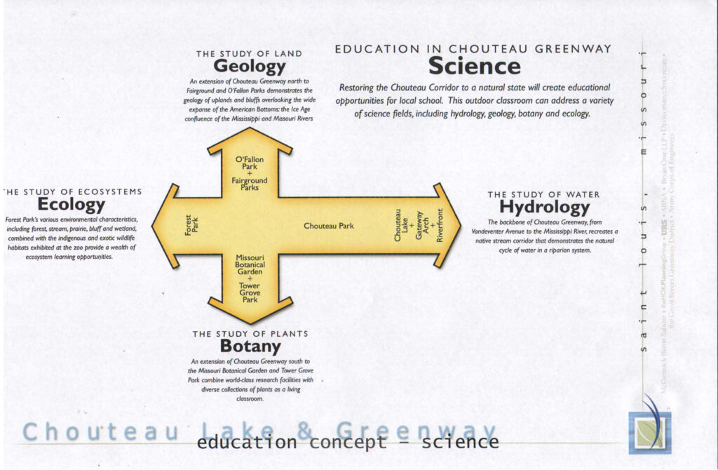
Aside from being an ongoing missed opportunity for the Central Corridor, the sprawling Chouteau Lake and Greenway plan included ideas for connecting a north/south and east/west axis both physically and symbolically. The CLG inventoried the cultural assets of Tower Grove Park and The Botanical Gardens in South St. Louis, The Zoo and Forest Park to the West, The Gateway Arch and Riverfront to the East, and looks to the north imagining how North St. Louis might connect and compare. Keeping with the theme of natural sciences, the plan suggests the North as a cultural center for geology.
But, while a center for geology would be an excellent addition for St. Louis, the key point here is that the South, the West, and the East have key public institutions that help bolster and maintain development in those areas, and add a lot to the civic identity and sense of place to these neighborhoods. These areas marry large public greenspaces with large cultural institutions, creating places that work as both destinations and neighborhood recreation centers. This in-turn has made them desirable places to visit and live.
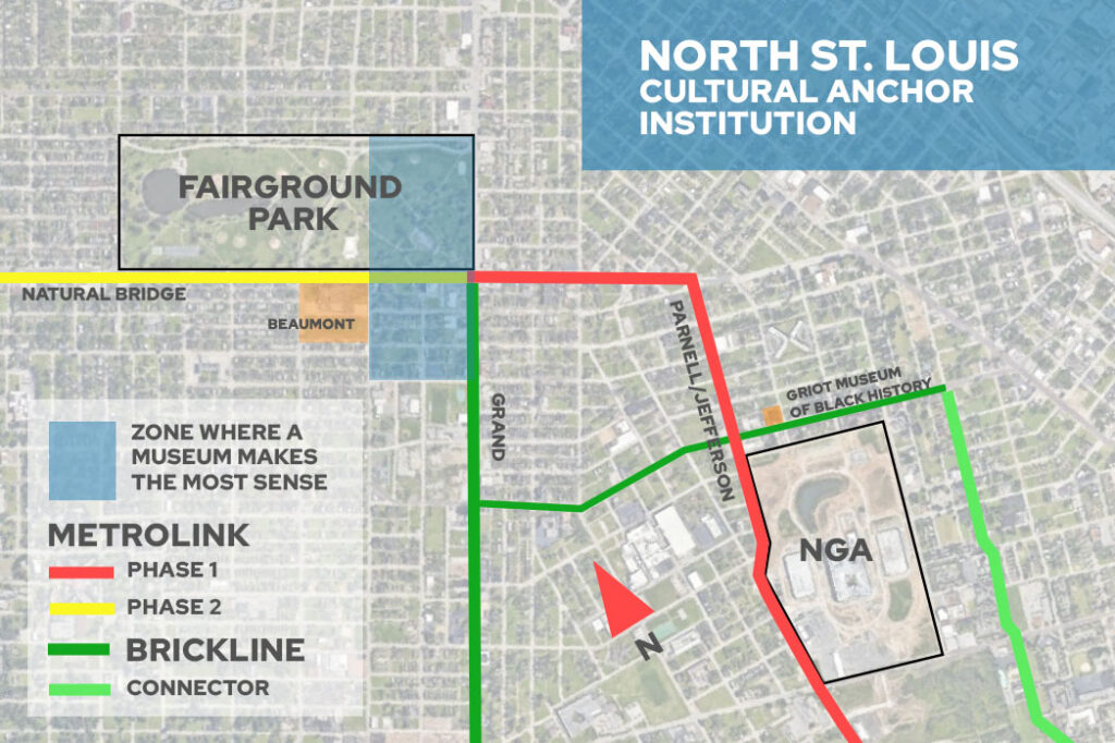
That place in North St. Louis may very well be Fairground Park. Nascent plans for biking and transit including the North/South Metrolink alignment converge upon Fairground Park making it an important link in the string-of-pearls that many hope collectively work to bring investment and stability back to North St. Louis neighborhoods. What comparison with these other areas suggests is that Fairground Park ought to be paired with an institution that has draw for visitors, locals, and neighborhood residents alike(not to mention a non-profit organization like Forest Park Forever to help support it.) There are many cultural institutions that could fill this role, and a local, state or national map museum–perhaps alongside secondary and post-secondary education opportunities in geospatial (the former Beaumont High School, now SLPS’s Beaumont Technical Center along Natural Bridge would seem a good opportunity for collaboration here)–could mean the difference between neighborhood civic identification with the NGA and merely forced-proximity with a gated spy agency.
St. Louis was once the center of a growing nation. Now, it grapples with the three-fold challenge of confronting its legacy, drawing in new people(or at least staying its losses), and developing long dormant historic spaces (thanks to diligent work of a trailblazing and dedicated preservation community) into catalyzing places, such a museum could arguably do all three in the right context, and help keep STL on the mapping map.
