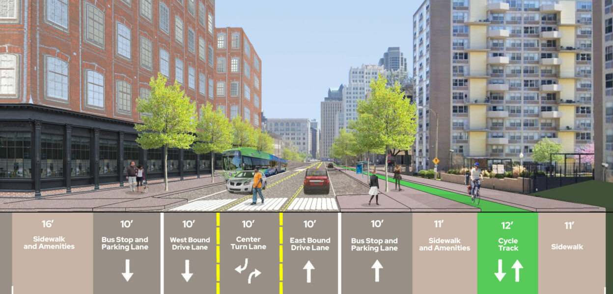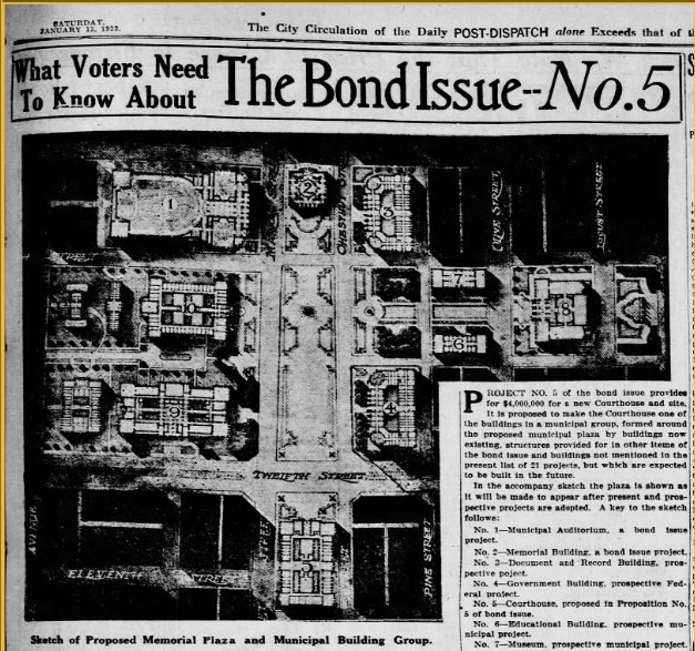
One-hundred years ago this year St. Louis voters passed an $87M ($1.5B today) bond referendum to make major changes to Downtown St. Louis. Among the projects funded–which included demolition for the Gateway Mall and the suite of municipal buildings built along it–was widening Tucker, Market, and Olive in Downtown West, a project that was complete by the late 30s. While the street widening project made sense to planners and voters of the time trying to cope with the explosion of population and automobile use in the 20s and 30s, one hundred years later a depopulated St. Louis with critical traffic safety issues, and an eye toward multimodal transportation more often considers the legacy of these super-wide streets as a liability to be addressed.
A number of STL planning initiatives released in the past five years endeavor to address these problem streets in Downtown West and elsewhere. Among them are the 2018 Downtown St. Louis Transportation study, Trailnet’s 2019 Connect St. Louis Plan, 2020’s Design Downtown STL plan, and Great Rivers Greenway’s Brickline Greenway. Each of these studies and plans come to a similar conclusion: These broad and often tree-barren streets can and should be narrowed to increase pedestrian and bicycle safety in the area, beautify the landscape, and remediate disconnection from east to west and from north to south.
To that end, a number of street improvement projects along problem corridors are in either the planning, funding, or implementation phase. Additionally, the passage of the $40M St. Louis Safer Steets Bill earlier this month, seeks to fund street improvements across St. Louis. This article discusses individual projects along corridors in Downtown West, asks what might be missing, and proposes coordination upon a milestone of progress in this pivotal neighborhood.
Brickline Greenway Along Market St.
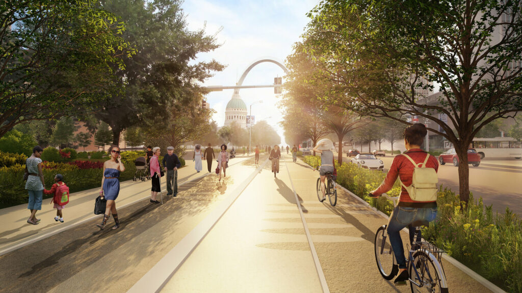

The most conspicuous of these improvements is the Brickline Greenway, specifically the portion along Market Street from 20th street to the Gateway Arch. While Great Rivers Greenway has released layout images for the stretch of Market between Compton and 20th, and a small portion to the south of CITYPARK has been completed as part of the stadium campus construction, in-depth plans for the portion along Market from 20th to the Arch–aside from Stoss Landscape Urbanism’s concept image and corridor recommendation above, remain to be seen.
The image, looking eastward down Market near 7th (with Peabody Plaza cleverly just out of the frame), shows an extra-wide pedestrian and bike lane, ostensibly a merging of the Gateway Mall’s “hall” feature and the Greenway’s bike path. While I’ve previously suggested it might be simpler and safer to build the Brickline’s cycle track along Chestnut, a hybridization of the Brickline and Gateway Mall Master Plan would breathe new life into the excellent, but stalled Gateway Mall plan while simultaneously accomplishing a road diet for Market St.– a win-win.
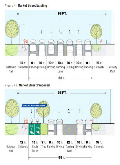
Studying the concept image above, it’s difficult to tell whether the little white car on Market to the right is meant to be moving or parked. In this configuration the added area for the greenway would necessitate annexing the parking lane on the northside of Market which continues almost entirely uninterrupted from Broadway to 20th where, tellingly, the parking lane appears to have been removed adjacent to CITYPARK.
Additionally, this all appears consistent with the proposed road diet for Market in the Design Downtown STL plan (left). If indeed these proposals are adopted, theoretically that little white car in the concept drawing is a parked car, and Market shrinks in drive width from 50 to 32 feet. With the likely addition of curb extensions bounding the parking lanes to either side, this would be a drastic improvement in pedestrian safety crossing Market all the way from 20th to the Arch.
Jefferson Ave and 20th Street Project
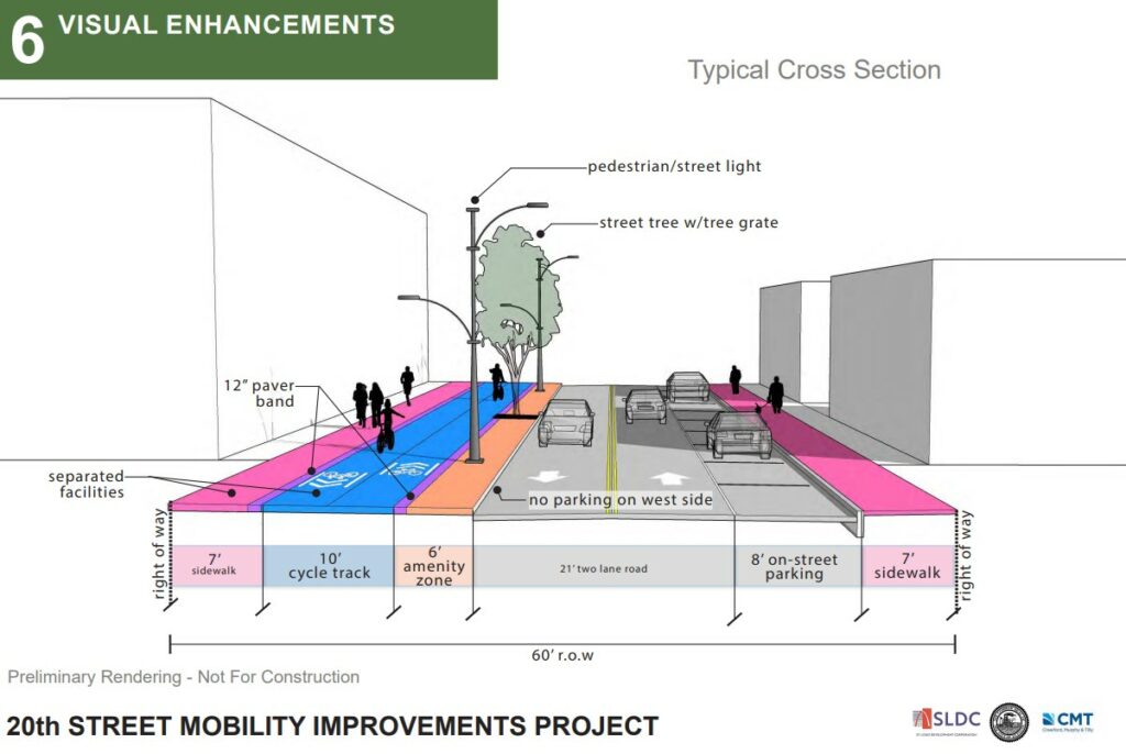
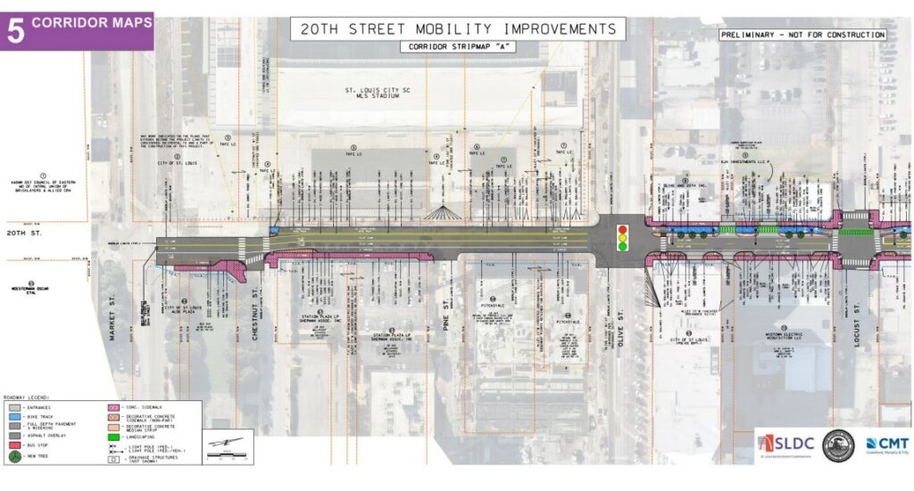
CITYPARK also marks one end of St. Louis City’s 20th Street Mobility Improvements Project. In collaboration with GRG and Project Connect, this federally funded project reconstructs 1.6 Miles of 20th Street from Market to St. Louis Ave, connecting Downtown West with St. Louis Place Park and the NGA campus. Expected to begin construction in 2024, the plans feature a 10ft cycle track along 20th Street’s west side, a 21 ft road width, and parking on its east edge with curb extensions and street tree additions along the entirety of its length.
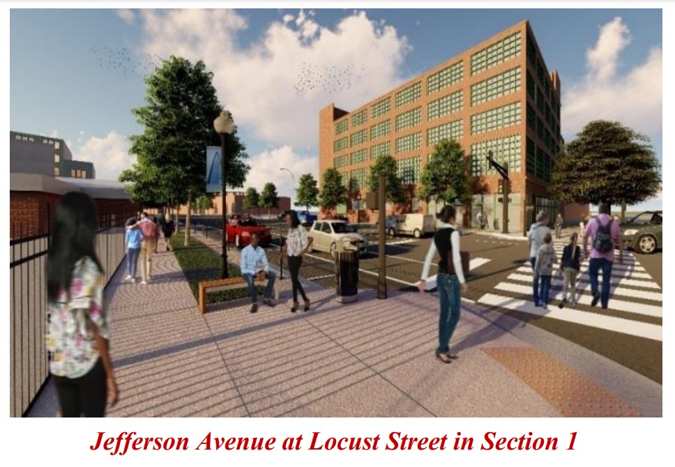
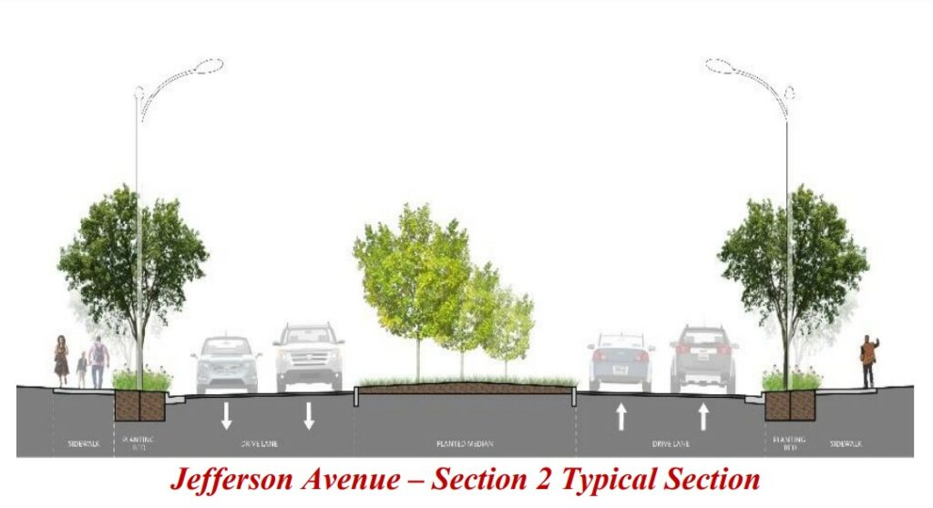
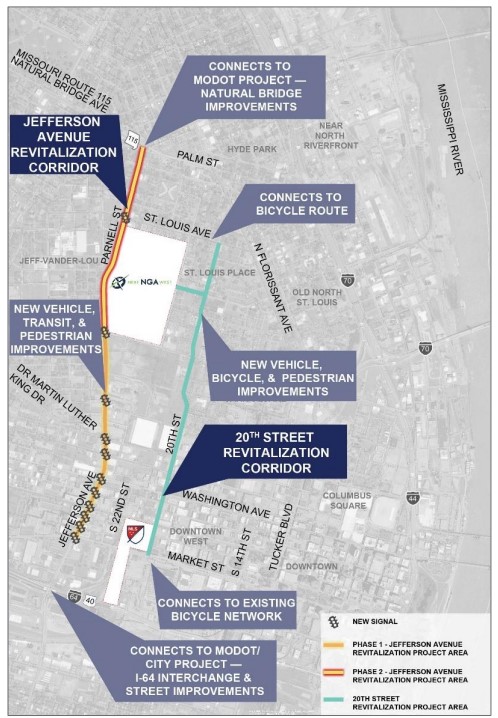
The 20th street project is in direct relation to the coming (and also funded) transformation of Jefferson Ave from Market St. to Natural Bridge Ave, as part of the Jefferson Ave and 20th Street Revitalization Corridors plan, meant to take advantage of the new NGA campus at its northern end. The Jefferson corridor project reduces driving lanes from six to four, and removes the uncomfortable and thus underutilized bike lanes along Jefferson completely, with 20th street as the preferred bike alternative. Additionally this “complete streets” project, which includes new sewer, roadway, pedestrian, and traffic light improvements features an extra large 27ft wide center median, meant to accommodate the future North-South Metrolink expansion along Jefferson.
Trailnet’s Bike-Walk-Bus Project on Tucker Blvd
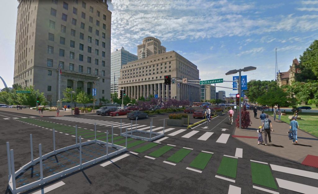
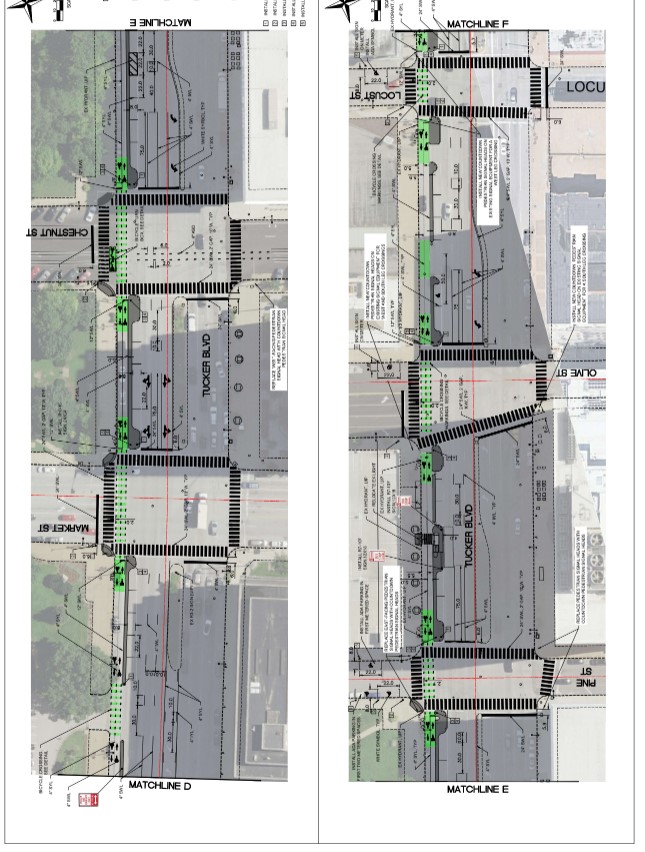
At the eastern end of Downtown West, another federally funded (TAP grant) project slated to begin construction in the coming year is Trailnet’s Tucker Bike-Walk-Bus Project, part of their Connecting St. Louis plan. The project encompasses .9 miles of Tucker Blvd from Chouteau Ave north across the 12th street bridge to Washington Ave, and features a protected cycle track along Tucker’s western edge bounded by a parking lane with curb extensions reducing Tucker’s southbound traffic lanes to three. The project does not appear to account for the eastern edge of Tucker, where additional curb extensions are needed to address this most drastic of ped and bike crossing expanses.
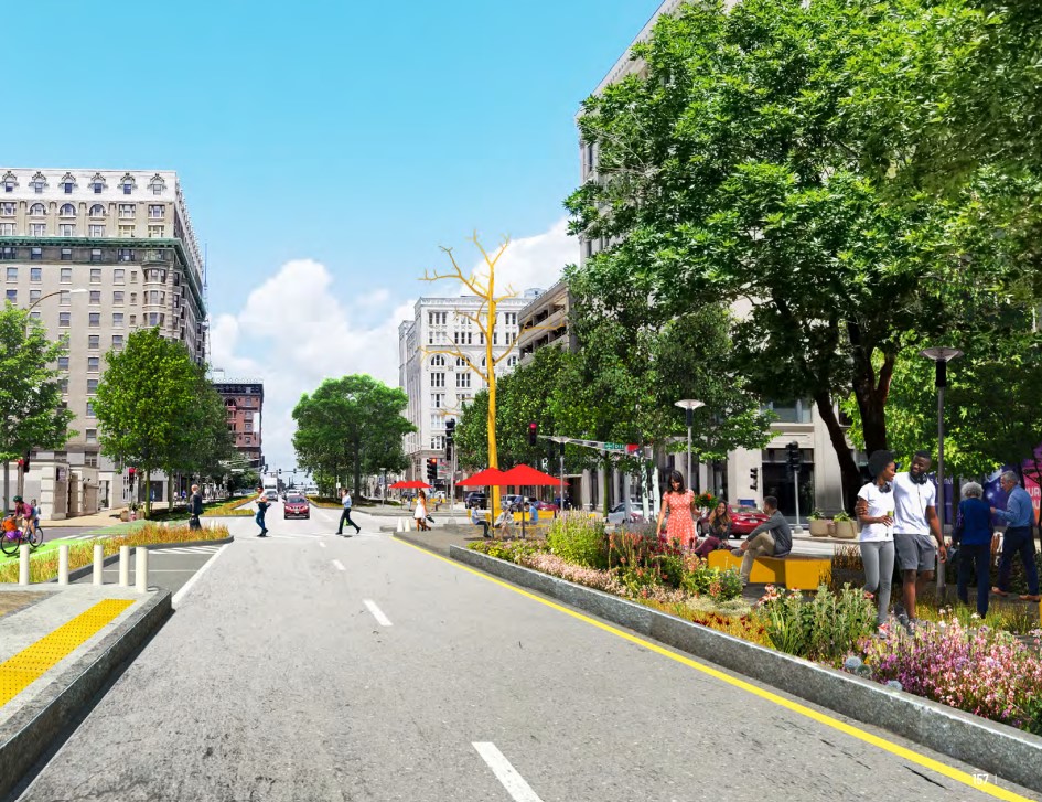
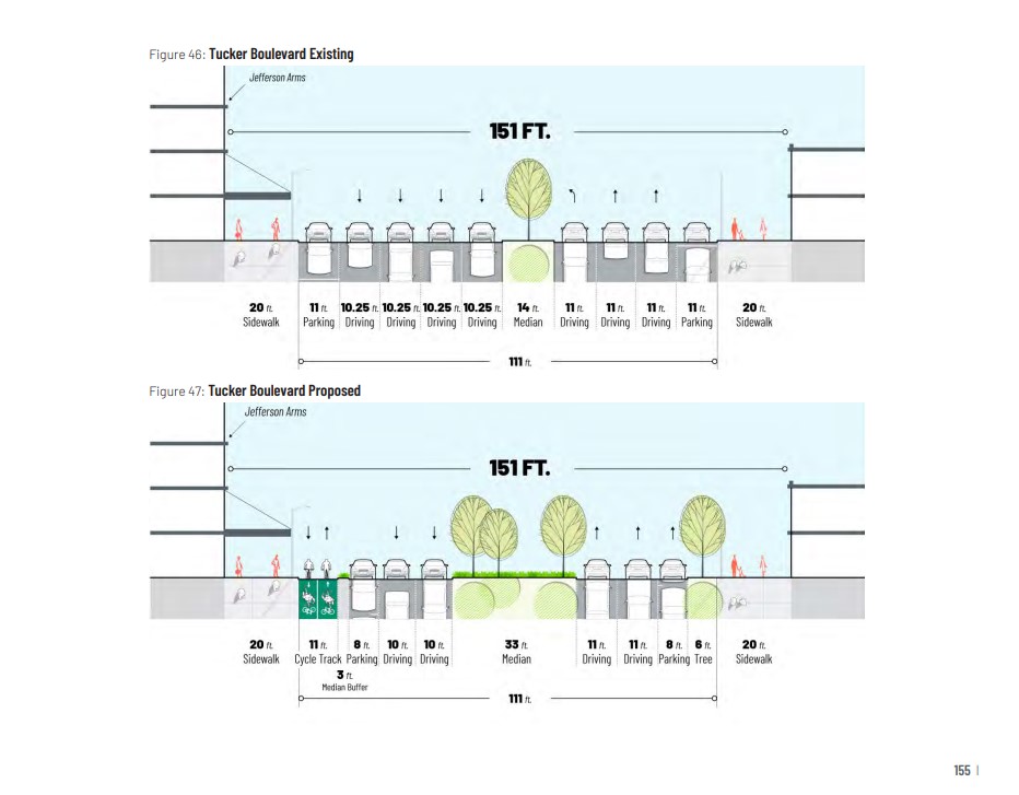
Design Downtown imagines a slimmer road diet for Tucker, reducing driving lanes to 2 each north and southbound and introduces an extra large 33ft median (which would presumably be reduced for turn lanes). With curb extensions in place, Design Downtown’s plan would reduce ped crossing to 2 separate ~20ft-~30ft expanses. While it’s hard to imagine people hanging out in Tucker’s median as implied in the plan’s concept images, this would make for a pretty comfortable pedestrian experience, a must if we’re to expect bikes and pedestrians to want to cross Tucker along the Brickline or otherwise.
What About Olive Street?
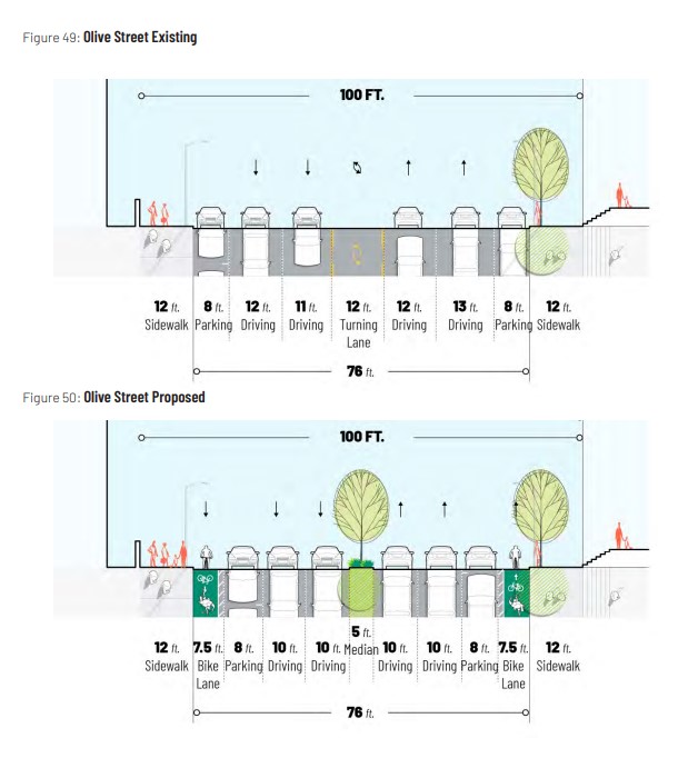
Olive Street, Downtown West’s remaining over-wide street and the first to be widened a century ago does not appear to have an active corridor project outside of road diets proposed by the Design Downtown documents (above), and the small improvements made along CITYPARK. This is unfortunate for a number of reasons–not the least of which is that it is currently the bleakest driving and pedestrian experience of the streets discussed, and has suffered the most from the effects of its widening.
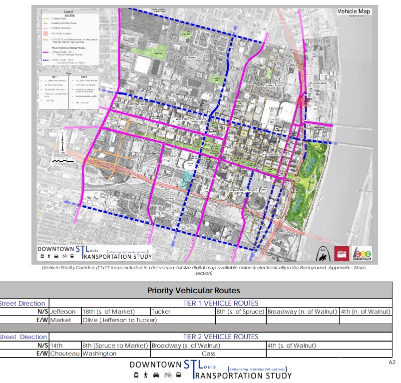
All of the currently active projects are backed in some respect by St. Louis’ 2018 Downtown St. Louis Transportation Study which does not propose road diets, but instead designates many of Downtown’s streets in a 2-to-3-tiered system for each mode of travel (Pedestrian, Bike, Vehicular, Transit). The study designates Olive street as a second tier pedestrian street, and a first tier traffic and transit street. It fails to register as a priority bicycle street.
The Design Downtown plan seems to come to a less damning, if similar conclusion to reduce Olive from 5 lanes to 4 instead of Market’s proposed 3 within a similar ~100ft total street width, expecting it to shoulder more vehicular and transit burden, a kind of alleyway to Market’s more public-facing facade.
However, given Olive’s capacity for residential infill (as discussed in Design Downtown), along with all the residential already there(It may come as a surprise but since 2000, Downtown and Downtown West neighborhoods have the fastest growing population in the city), its connection to the stadium district, and its current reputation as a formidable barrier between an active Washington Ave and Market street, Olive should be top of mind when considering Downtown West traffic safety improvements.
As witnessed by one recent tragedy downtown involving a tourist, and the political fallout in its wake, the visitor experience of our downtown neighborhoods is exceedingly important to the reputation of the area. Additionally, the Olive/Lindell corridor is the only corridor in Downtown West that makes Trailnet’s list of top pedestrian crash corridors in their 2022 St. Louis City and County Crash Report. With the tourism interests along Olive, such as Central Library, Soldiers Memorial, and the Campbell House Museum, and all other way-points that necessitate crossing it, we can’t afford to neglect Olive when implementing traffic safety infrastructure in Downtown West. With this in mind, and taking into account the other active projects in the neighborhood, I’d like to suggest closing the loop in Downtown West by adding Olive to the slate of imminent improvements, and focusing on a “ring” of street improvements as a collaborative (1.5 mile) milestone between these disparate plans.
Olive Street Improved
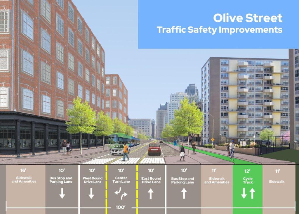
While some of the mentioned studies consider Olive to be a major traffic arterial, that is not currently the case. Downtown West traffic movement on Olive is sparse under most normal conditions. Olive could be reduced to three traffic lanes and thus a 30ft pedestrian crossing. If you find this to be a dubious claim, consider that the St. Louis Police Department has reduced lanes to three in front of their Olive St and 20th Headquarters for the past few years, and the reduction there has not created congestion.
While Design Downtown envisions a different road diet with similar amenities to the layout above, it has a few issues. It breaks up its 45ft pedestrian crossing width with a 5ft median/traffic island, which at that width is uncomfortable and potentially dangerous. This design also moves street trees to the center of the street, which is less than optimal for the shade they could provide elsewhere, and the symmetry of the street layout.
Additionally, their layout puts bike paths on each side of the street, in keeping with the current painted bike lanes on Olive to the west. However, consolidating those lanes to the south side of the streets makes sense to create easier connections with other improvements in the neighborhood, save street space, align with more available space on Olive west of Jefferson, and to make the traffic transition less awkward where Olive reduces to two one-way lanes going further Downtown across Tucker. That said, if four lanes of traffic is indeed Olive’s fate, a diet similar to Jefferson’s that nixes bike lanes in favor of a flexible and comfortable median space is preferred.
Design Downtown’s plan also imagines residential infill in the space occupied by parking lots between 15th and 16th streets, a prospect that would be far more likely with a streetscape that would support it. (You’ll forgive me if I’ve imagined that infill as a brick and steel construction more in keeping with downtown’s historic aesthetic, and not as an ultra-modern 5-over-1 Borg cube.)
Putting a “Ring” On It
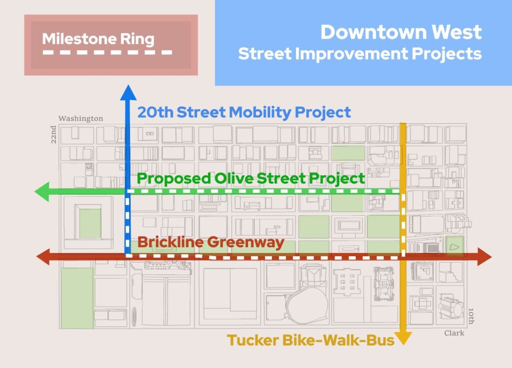
While these disparate street improvement projects have their own timelines, creating and celebrating a ring of traffic improvements that encircles the city’s civic center would be a milestone for traffic safety progress in the region, a wise use of the current momentum, a historic redemption for Downtown West, and would help ensure coordination from the many stakeholders involved.
While the same 100 year old project helped create the civic heart of the region, the broad boulevards it left in its wake, somewhat ironically, hold back Downtown West from being the vibrant neighborhood, municipal center, and tourist destination it ought to be. But, perhaps redemptively, all that extra space leaves ample room for the 21st century amenities we might enjoy, and the infrastructure to keep them safe. A full ring of traffic improvements here, along with those on the Jefferson Ave corridor, would go a long way toward re-activating this civic center’s surroundings, (I’m looking at you 1300 Market, the vacant Municipal Courts building, why aren’t you a museum already?) and ensuring a better downtown experience for everyone. If we’re finally taking street improvement in Downtown West seriously, let’s not leave Olive out of the mix.
