If this kind of analysis excites you, it’s similar to what a firm called Urban3 out of Asheville, NC led by Joe Minicozzi does. We’re trying to get them to do an analysis of St. Louis. That takes considerable funding. If that’s something you’re interested in helping with please email me at richard at nextstl.com

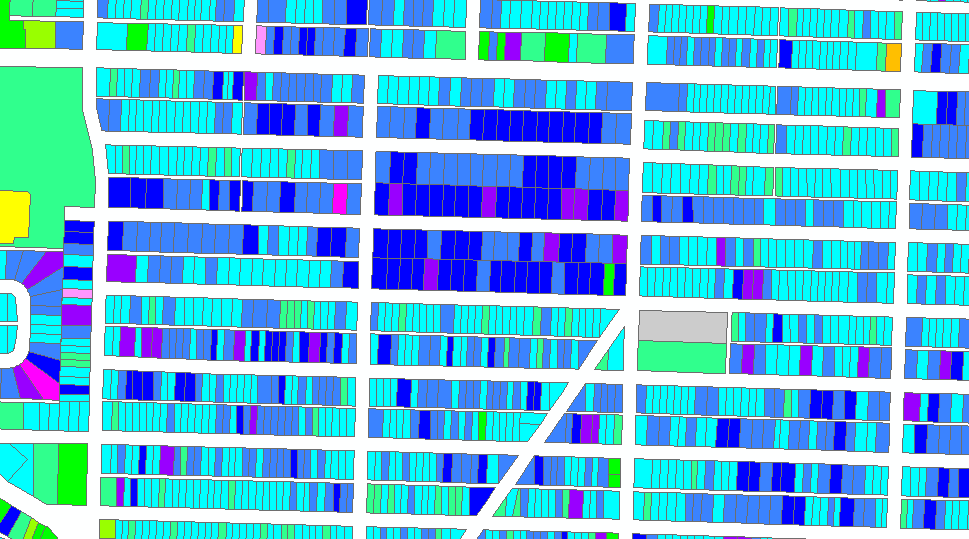
I’ve mainly been examining commercial corridors around St. Louis so far. While looking at a heat map of assessed value per acre, I noticed a cool spot in south St. Louis city, in the Southampton neighborhood, that warranted a closer look. There seems to be a negative correlation between frontage and value per acre. Let’s look at the area bounded by Chippewa, Sulphur, Landsdowne, and Brannon. Let’s do the math!

Leaving out the four-families, commercial properties, and the school, the study area is 66.44 acres with total assessed value of $11.2M or $169k per acre. The average assessed value per parcel is $21k. The area was 90% built-out by 1950.

Let’s separate the parcels into two groups. The “svelte” group are parcels with less than 43.5 feet of frontage and the “fat” group with more frontage. Per parcel the fatties average $21,864, and the sveltes are at an average of $20,446.
 {Examples of the “sveltes” – Google Streetview}
What is striking is the contrast between the two groups in assessed value per acre. The sveltes come in at $196,894 per acre while the fatties come in at $123,322 per acre. That’s a difference of $73,572. Had the entire study area been of the svelte variety the total assessed value would be $13,082,560, $1,878,330 or 16.8% more. That’s $142,471 in potential total property taxes each year. The city made a poor development decision when these were platted many decades ago, thus have come at a high opportunity cost. Worse many of the entities that receive property taxes had no say in the development decision (Some didn’t exist like the ZMD).
 {Examples of the “fatties” not pulling their weight – Google Streetview}
This amounts to a hidden subsidy for the fatties. With more frontage they have more feet of street, more feet of water and sewer pipes, more feet of power lines, more streetlights, service providers have to travel further, etc. One saving grace is that a couple of the blocks don’t have alleys to maintain, though this ruins the aesthetic of the street in my opinion.
 {Recent sales indicate that the market doesn’t heavily favor the fatties.}
What is done is done in the study area, but in future development decisions, the city, planners, neighborhood stakeholders, and developers should consider the impact of large frontage parcels. It is crucial for the city. Skinny houses on wide lots are too common in recent developmetns. Decision makers need to think of the buildings and land as a portfolio, consider which ones are higher returning and take a long view.
 {Skinny houses on wide lots on 4200 N Market. Those side lots come at a high cost the city. – Google Streetview}
A developer will move on, but the city is a corporation that will endure. Even if the market doesn’t value the land highly, the city (and any city) must treat it so, especially if it can’t add land area. Without higher productivity land uses we’ll never be able to afford the level of infrastructure and quality of services we desire.
