 New York built the first elevated railway line in the country on
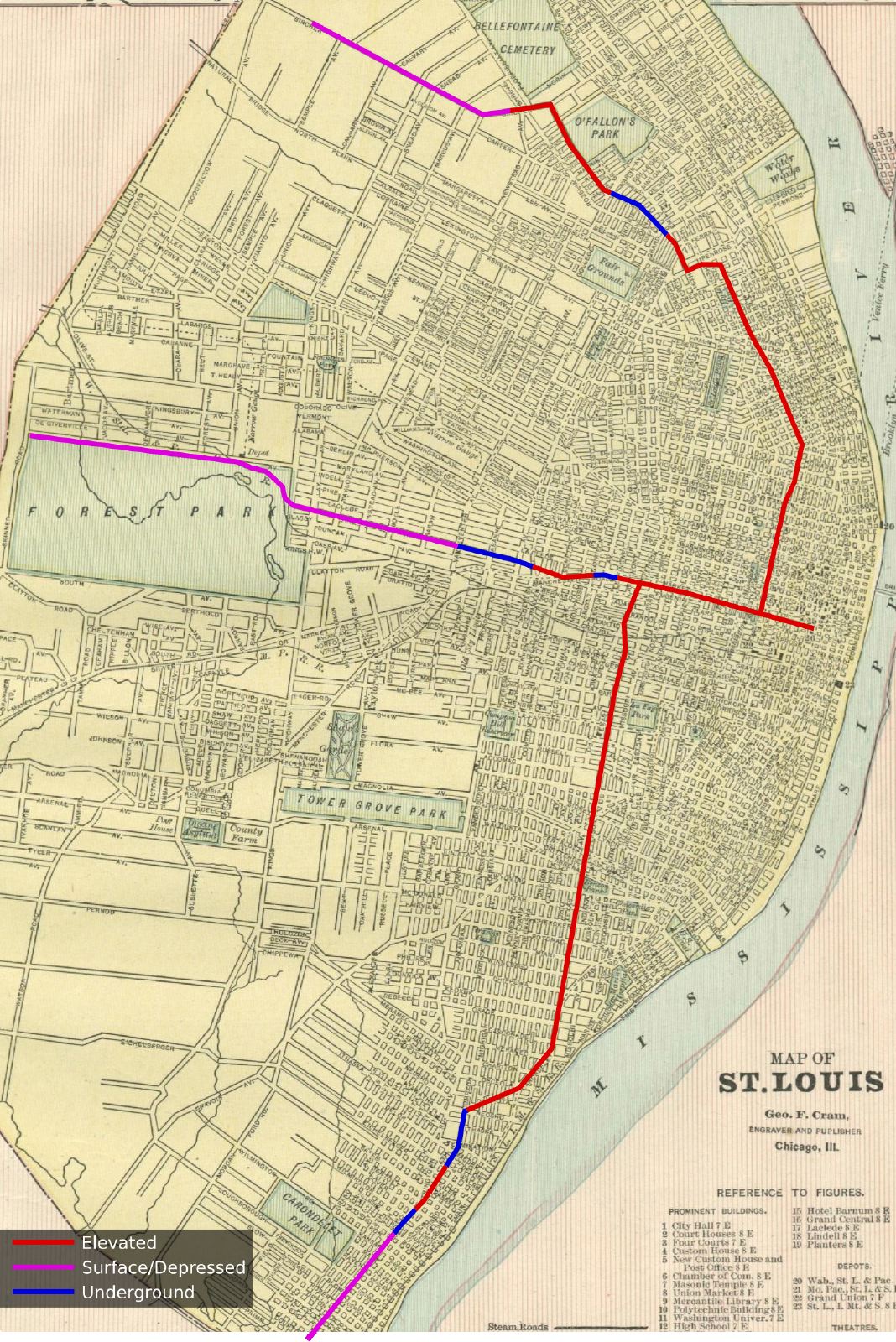
 New York built the first elevated railway line in the country on Ninth Ave in 1868. After replacing the initial cable propelled system with steam locomotives, the elevated system began expanding rapidly. By 1882, 3 more elevated railway lines extending over 32 miles had been built and yearly ridership exceeded 85 million. Real estate surrounding the elevated rail lines saw their values increase tremendously.
Inspired by the success of the elevated railway system in New York, a group of investors sought to do the same in St. Louis and, in 1882, formed the St. Louis Elevated and Rapid Transit Railway Company.
The company proposed to build a three line system focused on an elevated terminal at Fifth and Walnut streets. From there, the lines would branch to the west via Walnut St and Forest Park Blvd, to the north via 12th St, and to the south via Jefferson Ave to points near the St. Louis city limits. The map to the right is drawn as closely to the route description as possible, overlaid on a map of St. Louis from 1890.
The extent of the system would have been 19 miles: 10.5 miles elevated, 2 miles underground, the remainder at or depressed under the surface in an open cut. Whereas a trip from downtown to 20th St, at the time, took 20 minutes and 1.5 hours to reach the city limits, a trip to the city limits via the elevated railway was predicted to take only 15-20 minutes thus opening up vast stretches of the city to increased development.

Obviously, nothing ever became of this proposal. Rapid transit would not be built in St. Louis for over 100 years with the introduction of MetroLink in 1993. Still, it's interesting and surprising to see just how closely this century old proposal tracks to the route of the present day MetroLink system and its proposed extensions. And it's interesting to think that St. Louis may have had an 'L' before Chicago.
