

 The Partnership for Downtown St. Louis has released an RFQ (PDF below) for consultants to "a streetcar feasibility study for connecting the areas of Downtown, Midtown, CentralWest End, and Skinker-DeBaliviere in the City of St. Louis". This is step one in a long, necessary process that must be followed to develop a streetcar line. Citizens for Modern Transit offered a mock-up of the best potential route (image below). The Post-Dispatch put a piece online titled "So you want a streetcar, eh?" and offered a wacky Locust-Olive-Walton-McPherson route (OK, Locust would be pretty cool). Here's why the only feasible route will prove to be Olive-Lindell:
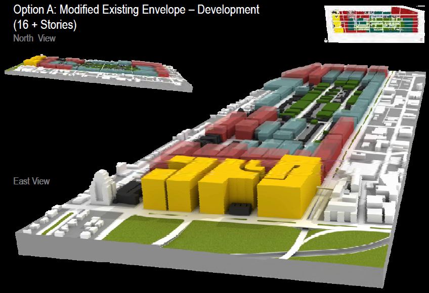
Below is the proposed form-based zoning code being proposed for the south side of the Central West End (north side of the 17th Ward). Public meetings were held over the summer of 2009 to explore development patterns to be pursued by the CWE. The hope is that a new form-based code will eventually replace existing zoning. As can be seen in the image, the new zoning would seek development of 10+ stories along significant corridors that would be served by a Lindell line. What would this theoretical height envelope look like?

Ultimately this is why a streetcar line must use Lindell Boulevard and not Olive west of Grand, or any other route. Not only does such a fixed, long term transit investment need to serve existing density, but it needs to exist where there is true opportunity for increased density. If one looks closely, the opportunity for redevelopment of Lindell from Vandeventer to Kingshighway is enormous.
Infill such as 3949 Lindell is taylor made for a streetcar line. The AAA building site, the American Red Cross building, the entire block across from the Lindell Marketplace (and the Marketplace itself) can all be redeveloped for increased density. Farther west you have a large, deteriorating corner gas station, a one-story bank and other opportunities. Then, surrounding the Euclid intersection there is a vacant building, a parking lot, and a half-dozen other surface or vacant lots within one block. And all of this has the potential for high-rise development.
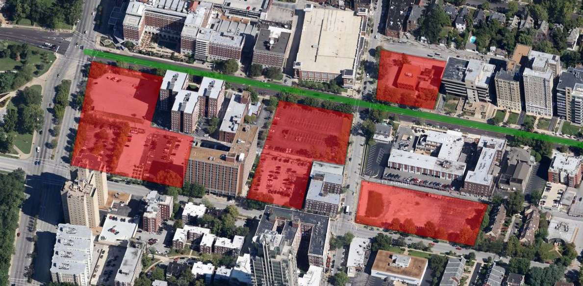
{incredible development potential exists at the western end of a Lindell line}
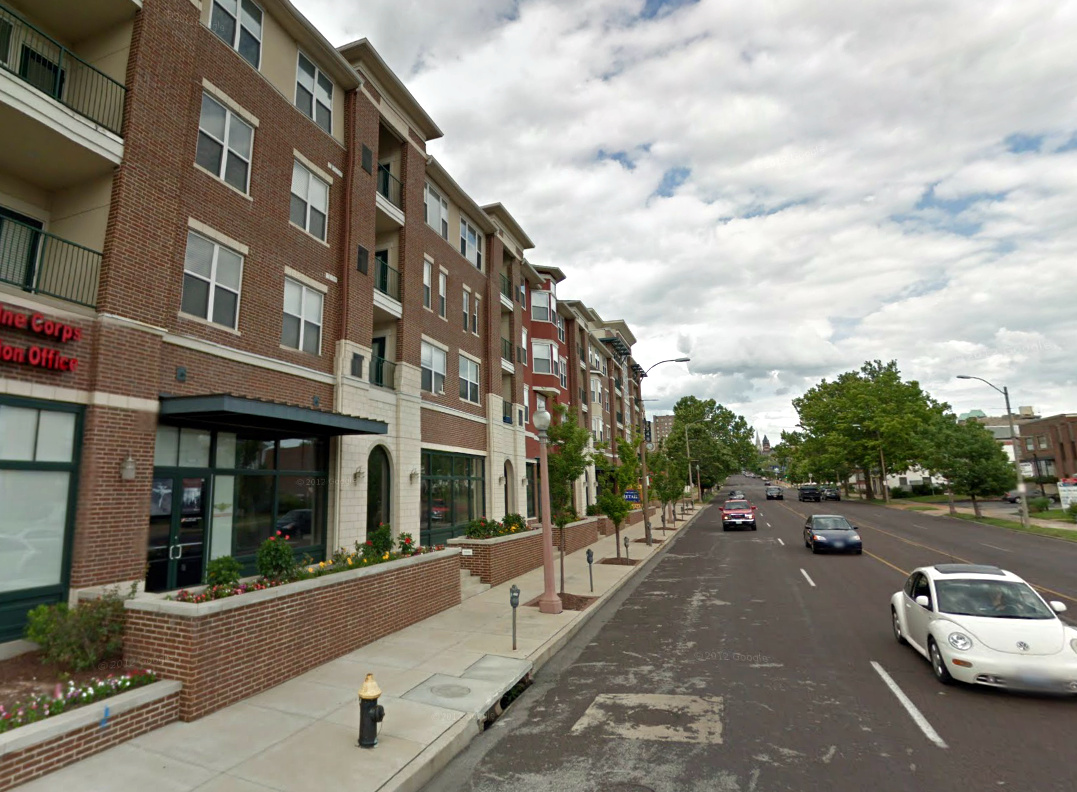
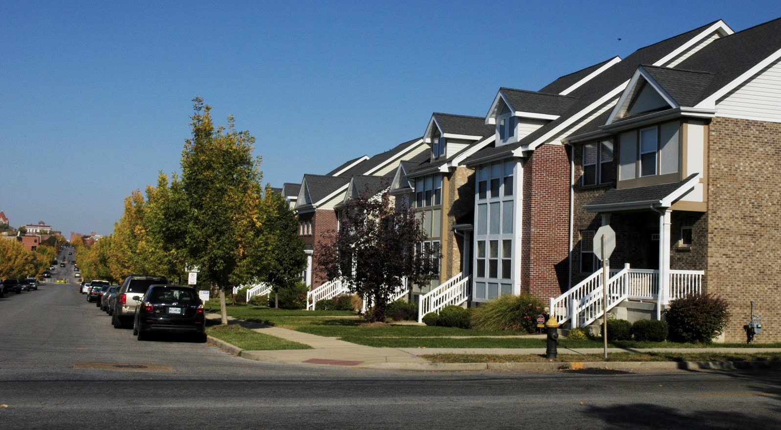
{developments such as 3949 Lindell, catering to St. Louis University students and others seeking an urban lifestyle are a perfect fit for a streetcar}
When and if this development occurs is another issue, but the chances of success along the Lindell corridor are much greater than Olive. The Park East Tower and 4545 Lindell show that high-rise development can and will continue to be built in this part of the CWE. Similar development is exceedingly unlikely a half-mile north. Sections of Olive are beautiful, but lack density to support a streetcar and are too far removed from destinations and job centers to attract new dense development.
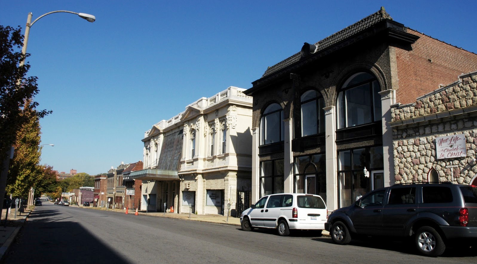
{a view of Olive near Taylor Avenue}
{a view of Olive at Sarah Street}
The lure of an Olive streetcar is one part pure nostalgia and one part putting the hoped-for rehabilitation of a once-great street ahead of real transit. On Olive, a streetcar would be grasping for opportunity (vacancy). On Lindell, a streetcar builds on strengths, existing density and the best potential for a car-free neighborhood in the region. Olive is a beautiful street for stretches, seemingly ripe for reinvestment and there's no doubt that a streetcar would be good for Olive, but would be it good for a streetcar?
The successful model for transit development isn't 2,500 sqare foot rowhomes and vacant lots, with a low-rise historic commercial district. Transit necessitates density and the potential for more. In an urbanist's wildest dreams it difficult to imagine sustainable density centered on Olive and Newstead – though it's a great dream.
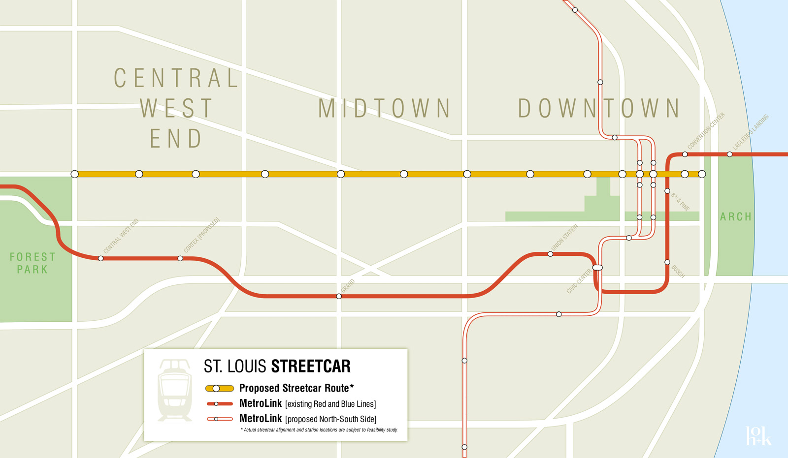
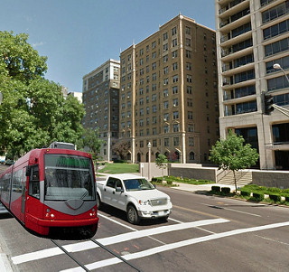
{Citizens for Modern Transit included this image in their online post regarding the streetcar}
And all of this leaves out the impracticality of an Olive streetcar in terms of actual service, you know, the reason transit is built. On Lindell, a streetcar would give direct access to the Lindell Marketplace for Downtown, Midtown and CWE residents. It would give access to the Cathedral, to the heart of the CWE commercial district, to Forest Park and near access to the WU/BJC Medical Campus. An Olive line? None of those. An Olive line would deliver one to the vague northern end of the CWE.
An Olive line also would not adequately serve the Saint Louis University Frost Campus. Sure, it would be just a block or two north of the heart of campus west of Grand. But similar to the existing Grand Avenue MetroLink stop, the line wouldn't serve the needs of students, staff and visitors as well as a Lindell streetcar. If we're not building a transit system to best serve our anchor institutions and neighbrhoods, we're failing to understand transit systems.

{a Lindell streetcar would best create a dense, transit-oriented district – existing MetroLink in blue, Olive line in yellow and Lindell line shown in green}
A Lindell line would be a half mile north of the existing MetroLink. This is a perfect distance for creating a dense, sustainable, transit network. This is what is needed to effectively support transit development in St. Louis. And the line must be financed. This means large developments and dense development with enough value to subsidize the streetcar. A special assessment along Olive would result in a small fraction of what it would along the Lindell corridor.
The only problem remaining is the potential to connect to the Loop Trolley. This would be great, but has drawbacks as well. An Olive/Lindell streetcar could run efficiently and quickly with short headways along wide Lindell. Traffic is rarely an obstacle. The Loop Trolley (and any connecting streetcar) is going to be sitting in traffic from Skinker to U-City City Hall. The simplest connection, if sought, could be up Kingshighway, or possibly even Euclid. But the connection isn't essential for this line's success. The number of Loop to Midtown or Downtown trips would be rather small, and MetroLink provides quicker, arguably better, service for such longer trips.
Any consultant review of a possible Downtown to CWE streetcar is going to find the same issues identified above and come to the same conclusion. For effective, efficient transportation, the existing and potential density, as well as connections to destinations of the Lindell corridor make an Olive/Lindell line the only viable route for a central corridor streetcar.
City of St. Louis Streetcar RFQ
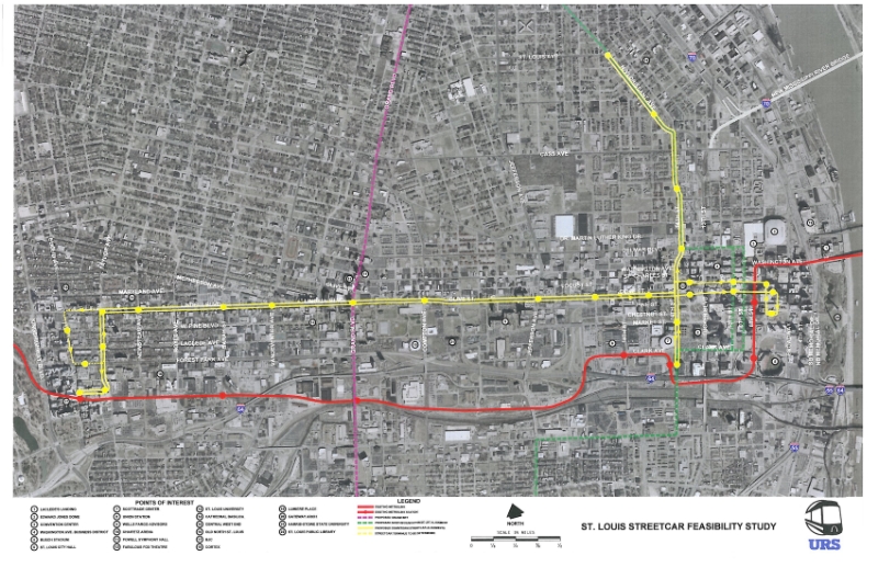
{proposed streetcar lines (yellow) – map added 2/25/13}
